Williamsburg Neighborhood Guide, Block by Block
Four different neighborhoods share one L stop and a bridge, and treating them as a single postcard is the fastest way to get Williamsburg wrong.
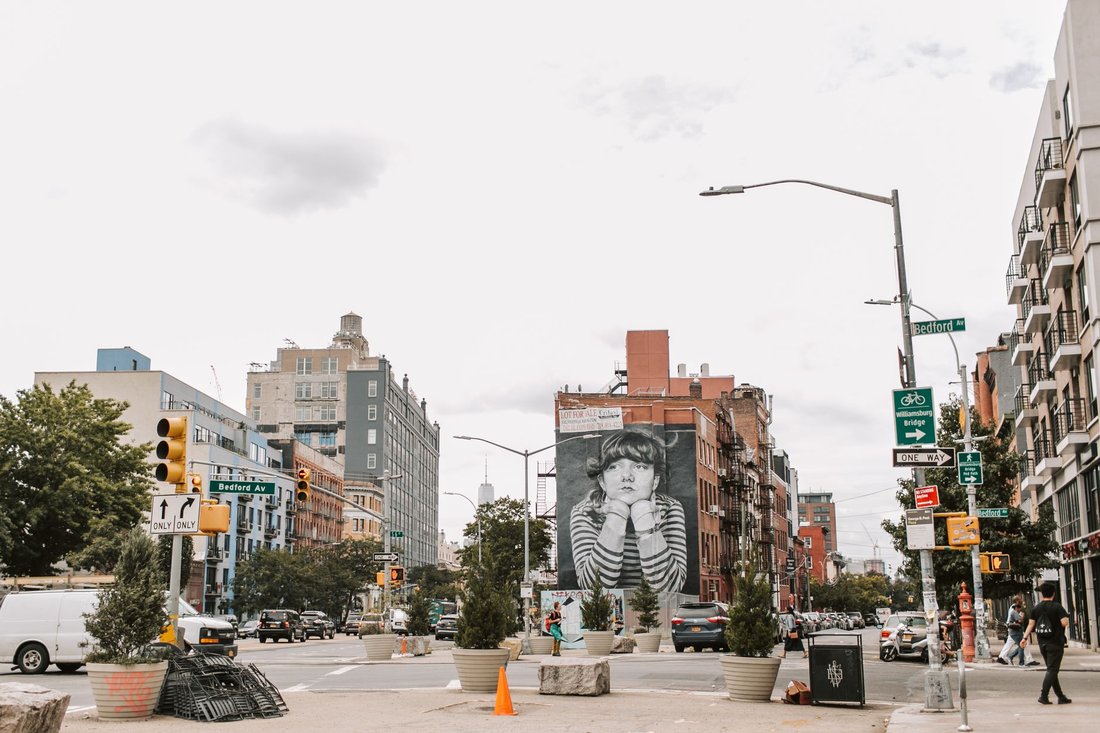
Step off the L train at Bedford Avenue on a Saturday morning and you clear the stairs into a scrum of dog walkers, vintage-shop clerks hauling up their gates, and a line already forming for whoever's selling the best bagels that week. Keep walking south for fifteen minutes, past blocks where warehouses became galleries became luxury rentals, and you land on Broadway under the JMZ, where the sidewalk smells like a halal cart and nobody on it is wearing a vintage band tee. This is the thing any honest williamsburg neighborhood guide has to say up front: Williamsburg isn't one place. It's four or five, stitched together by a train line and a bridge, and each one runs on its own clock.
Outsiders still talk about it like it's a single mood board of skyline views and record shops. Locals know better. The neighborhood splits along real, longstanding lines, and knowing which stretch you're standing on tells you more than any single Instagram grid ever will.
A Williamsburg Neighborhood Guide Needs More Than One Map
Start with the North Side, the part most visitors mean when they say "Williamsburg" without qualifiers. Bedford Avenue is the retail spine here, block after block of it, and the density of things to do only increases as you head toward the water. The neighborhood's reputation was built here in the 2000s and 2010s, and it's still where you'll find the highest concentration of natural wine bars, third-wave coffee counters, and shops that turn over their windows every season. It's also the most expensive, most photographed, and most crowded stretch on summer weekends, which is exactly why longtime residents increasingly talk about it as its own separate thing from "real" Williamsburg.
Walk west from Bedford and the neighborhood changes its whole center of gravity. Domino Park and the surrounding waterfront turned the old sugar refinery blocks into the place people go for a Manhattan skyline view that doesn't require a bridge toll or a ferry fare. Further north, East River State Park does the same job with less infrastructure and more grass, and Smorgasburg runs its outdoor food market in the area seasonally, drawing people from every borough for an afternoon that has nothing to do with any single restaurant and everything to do with the water, the skyline, and the crowd. The Williamsburg Bridge anchors the southern edge of this stretch, a working piece of infrastructure that happens to frame one of the better photographs in the city.
East Williamsburg Still Feels Like a Work Zone, on Purpose
Head east past the BQE and the neighborhood stops performing for anyone. This is East Williamsburg, the industrial belt that bleeds into Bushwick without much of a hard line, and it's where nightlife operators, artists, and small manufacturers have kept a foothold that got priced out of the North Side years ago. The buildings are lower, the blocks are longer, and the crowd on a Friday night skews toward people who work in the neighborhood rather than people visiting it. It's the part of any williamsburg neighborhood guide that gets skipped most often, which is exactly why it still feels unfinished in a way the waterfront doesn't.
South Williamsburg and Los Sures Never Left
South of the bridge and away from the boutiques is where the neighborhood's longest-running communities still anchor the streets. South Williamsburg is home to one of the largest Hasidic Jewish communities in New York, a presence that predates the loft conversions by generations and shapes everything from the storefront signage to the rhythm of the sidewalks on a Friday afternoon. South of the bridge is also serious territory for kosher bakeries and delis that have nothing to do with the neighborhood's rebrand and everything to do with the people who've lived there the whole time.
Along Graham Avenue, the area residents still call Los Sures carries the neighborhood's Puerto Rican and Dominican history, a Latino community that shaped South Williamsburg long before anyone was marketing lofts. Botanicas, Spanish-language storefronts, and family-run spots sit alongside newer arrivals, and the tension between the two is among the truest stories in the neighborhood right now. Nobody who's spent real time on Graham Avenue talks about Williamsburg as a finished product. It's still being negotiated, block by block, the same as it's been for decades.
McCarren Park and the Greenpoint Line
At the northern edge, McCarren Park blurs into Greenpoint entirely, and the border stops mattering much on a warm day. The park is where both neighborhoods actually converge, soccer games and dog runs and farmers market stalls, and it's a useful reminder that the map lines drawn on a real estate listing don't always match how people actually use the ground. If you're chasing a proper slice after a walk through the park, the choice usually comes down to which side of Manhattan Avenue you happen to be standing on.
What ties the sub-neighborhoods together isn't a shared aesthetic. It's the L train, the bridge, and a shoreline that keeps pulling people toward the water no matter which block they started on. The North Side gets the tourists and the wine bar crowd; East Williamsburg gets the after-hours crowd; South Williamsburg and Los Sures keep running on their own calendars, mostly undisturbed by either. Treat Williamsburg as one neighborhood and you'll misread all of it. Treat it as five, and the place finally makes sense.